

Tropical Storm Gezani Mozambique: Severe Impact in Inhambane and Gaza
Live Storm Update: What Has Changed in the Last 24 Hours
Updated: [2026-02-14]
Tropical Storm Gezani has intensified as it approaches southern Mozambique, with forecasts now indicating a more severe impact across Inhambane Province, Xai-Xai and wider Gaza Province than previously expected. Wind speeds remain strong over the Mozambique Channel and rainfall projections have increased in several coastal and inland districts already weakened by recent flooding.
Search demand has shifted rapidly toward urgent queries such as “Cyclone hitting Mozambique now”, “Is Inhambane safe today”, “Gezani landfall Mozambique”, and “Are flights to Inhambane cancelled”. This article serves as a rolling live update to provide verified, practical information for travellers, residents and anyone monitoring conditions in real time.
Storm Intensification and Updated Forecast Track
Satellite data confirms Gezani remains a well-organized tropical system with sustained circulation over the Mozambique Channel. Forecast models now show a stronger wind field and heavier rainfall concentration along the southern coastline.
Even if the eye remains partially offshore, the expanded wind radius means damaging gusts, intense rainfall bands and hazardous marine conditions are expected across exposed areas of Inhambane and Gaza. Storm effects are not limited to the center. Peripheral bands are capable of triggering flash floods and infrastructure disruption well inland.
Rainfall Projections and Flood Risk
Updated rainfall models indicate potential accumulations exceeding earlier projections in localized zones. With river systems including the Limpopo and Incomati already under strain, additional precipitation increases the likelihood of renewed flooding in vulnerable districts.
High risk zones include:
• Low-lying coastal settlements
• Flood plains near river basins
• Areas previously damaged by January flooding
• Peri-urban communities with limited drainage capacity
Ground saturation means even short-duration heavy rainfall may trigger rapid surface runoff and localized inundation.


Inhambane Province: Current Conditions
Wind speeds along exposed coastal stretches are strengthening, and sea state has deteriorated significantly. Maritime activity remains suspended in several districts. Beach access at numerous resorts is restricted and non-essential outdoor activity has been paused.
For those asking “Is Inhambane safe today”, urban centers with reinforced infrastructure remain under active storm protocols. However, exposed beachfront and low-lying areas carry elevated surge and wind risk. Travellers currently in Inhambane should remain indoors during heavy bands and follow local guidance without delay.
Tofo, Barra and surrounding coastal communities are experiencing increased wind gusts and intermittent heavy rainfall. Power interruptions are possible in exposed zones if wind intensity peaks.
Xai-Xai and Gaza Province
Xai-Xai remains particularly vulnerable due to prior flood damage. Updated rainfall projections increase the risk of additional flooding along weakened sections of road infrastructure.
Potential impacts include:
• Localized EN1 disruption
• Flooded secondary roads
• Temporary isolation of rural areas
• Power instability in exposed districts
Anyone planning overland travel through Gaza Province should verify current road status before departure. Conditions may change rapidly within hours if rainfall intensifies upstream.
Flights and Air Travel Disruption
Domestic routes linking Maputo, Inhambane, Vilanculos and southern coastal airstrips are under review depending on wind speed thresholds and visibility.
Travellers should:
• Check airline status directly before departure
• Expect rolling delays
• Allow flexibility for onward transfers
• Avoid non-essential short-notice travel during peak storm windows
Air operations typically adjust incrementally as crosswinds strengthen. Cancellations may increase if storm severity continues to escalate.


Coastal Resorts and Tourism Operations
Property Updates, Verified Information, and What This Means for Your Booking – Mozambique Travel is in ongoing contact with lodge owners and senior management teams across key coastal and safari regions. While weather events can generate understandable concern, we prioritize confirmed information over speculation. At present, we have received direct feedback from Massinga Beach Lodge and will continue updating clients as further verified reports are received from other properties.
Following a direct discussion with Massinga Beach Lodge, we can confirm that recent storm related damage has been limited. The impact has been described as minimal, with no major structural compromise to guest suites or core lodge facilities. Inspections have been completed, minor repairs are underway where necessary, and the property has confirmed a planned full reopening on 1 March.
It is important to recognize that coastal weather systems can vary significantly in intensity and localized impact. Conditions at one property do not automatically reflect the situation elsewhere. For this reason, Mozambique Travel does not generalize or downplay developments. Instead, we verify property by property, region by region.
For travelers with existing or upcoming bookings, this measured approach provides reassurance without false certainty. Where timelines shift, we communicate quickly. Where reopening dates are confirmed, we share them transparently. And where flexibility is required, we implement practical solutions based on two decades of operating experience in Mozambique’s dynamic coastal environments.
In periods of heightened weather attention, a seasoned and experienced tour operator becomes more than a booking channel. Direct owner relationships, established contingency networks, and calm logistical management ensure that travel decisions are guided by facts, not headlines. We will continue to monitor all regions closely and provide structured updates as verified information becomes available.
National Park and Remote Access
Access to national parks and conservation areas in southern Mozambique, including sections of Maputo National Park and more remote protected landscapes, may be temporarily restricted depending on rainfall intensity, river levels, and road viability. Dirt access routes, low water bridges, and floodplain crossings are particularly vulnerable following prolonged precipitation. Even when main highways remain open, secondary roads into park gates and coastal concessions can become unstable or officially closed pending inspection.
Self drive access into remote areas is not advised until updated clearance is issued by park authorities or verified by licensed operators. Conditions can change rapidly, especially where saturated soil weakens road structure beneath the surface. Vehicles becoming stranded not only create safety concerns but also divert limited local recovery resources.
Guided travelers should maintain direct communication with their operator for real time logistics planning. Established operators monitor park advisories, liaise with rangers, and adjust departure times or routing where necessary. In dynamic weather environments, structured coordination is far safer than independent decision making.

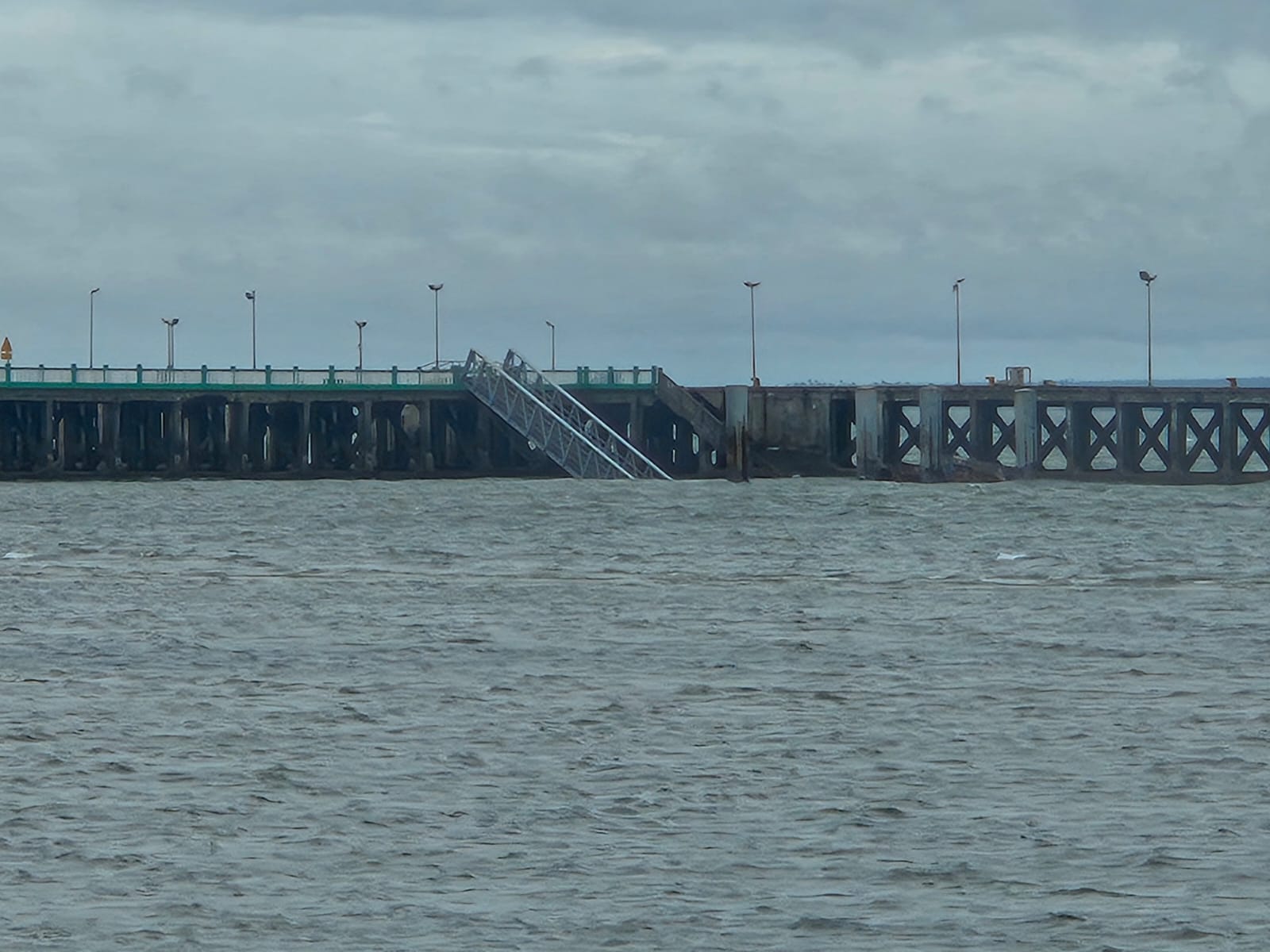
Sea Conditions and Coastal Surge
High seas are expected across exposed sections of the southern coastline, particularly along open Indian Ocean frontage where wave energy is amplified by wind direction and tidal cycles. Storm surge risk is elevated near estuaries, river mouths, and shallow coastal inlets where water displacement can move inland more quickly than forecast models suggest.
Fishing activity, recreational boating, diving charters, and non essential marine excursions remain suspended in affected zones until conditions stabilize. Even experienced local skippers will delay departures when swell period and wind alignment create unsafe launch conditions. Coastal inundation risk increases significantly if strong onshore winds coincide with spring or high tide cycles, placing additional pressure on low lying beachfront infrastructure.
Travelers staying in coastal lodges should expect precautionary suspension of ocean based activities until sea state returns to operational thresholds. This is a proactive safety measure, not an indication of structural failure.
How a Travel Safety App Strengthens Protection During Rapid Storm Events
In fast evolving storm situations such as Tropical Storm Gezani, access to structured, verified support becomes critical. A dedicated travel safety app such as TravelSafe SOS provides an additional layer of protection that traditional travel planning alone cannot offer. When weather systems intensify quickly, flight schedules shift, roads close, and local advisories change with limited notice. TravelSafe SOS delivers real time security alerts, official emergency contact numbers, and embassy and consular details in one secure platform.
The geo-location feature helps travelers identify the nearest hospital, police station, or safe evacuation point if conditions deteriorate. For visitors in remote coastal regions or those moving between provinces, having centralized, reliable information reduces dependence on fragmented social media updates. During infrastructure strain, knowing exactly who to call and where to go saves valuable time. In dynamic environments, preparedness is not alarmist, it is responsible. Pairing professional tour operator oversight with a trusted travel safety app significantly strengthens personal security, communication clarity, and decision making during high impact weather events.
Why This Escalation Matters
Gezani is impacting a region already weakened by extensive flooding earlier in the season. Saturated ground reduces natural absorption capacity, meaning even moderate rainfall can generate accelerated runoff. Infrastructure that has only recently been repaired may experience renewed strain. Community displacement in certain districts also increases vulnerability at a humanitarian level.
The cumulative impact of sequential storm systems increases both humanitarian risk and travel disruption. Repeated weather events compound stress on drainage networks, rural access roads, and electrical supply grids. Under these conditions, rainfall totals that would normally be manageable can produce disproportionate localized damage.
For travelers, the priority remains safety, flexibility, and verified information rather than speculation. Headlines often amplify worst case scenarios across broad regions, while on the ground realities vary district by district. The most responsible approach is controlled assessment, property specific updates, and structured decision making based on confirmed data.
Mozambique Travel continues to monitor park access, coastal advisories, and regional infrastructure status in coordination with property owners and local authorities. Travel decisions should be guided by professional oversight, up to date clearance information, and calm, fact based planning.
72-Hour Forward Outlook
Over the next 24 to 72 hours:
• Rain bands are expected to intensify in Inhambane
• Gaza flood risk remains elevated
• Road and flight disruptions may expand
• Wind speeds could peak along exposed coastal zones
This article will continue to be updated every 24 to 48 hours as new meteorological data becomes available.
If you are planning travel to southern Mozambique in the coming week, monitor official bulletins and remain in direct contact with your tour operator or accommodation provider.